Program Information
Flexible and Innovative Curriculum
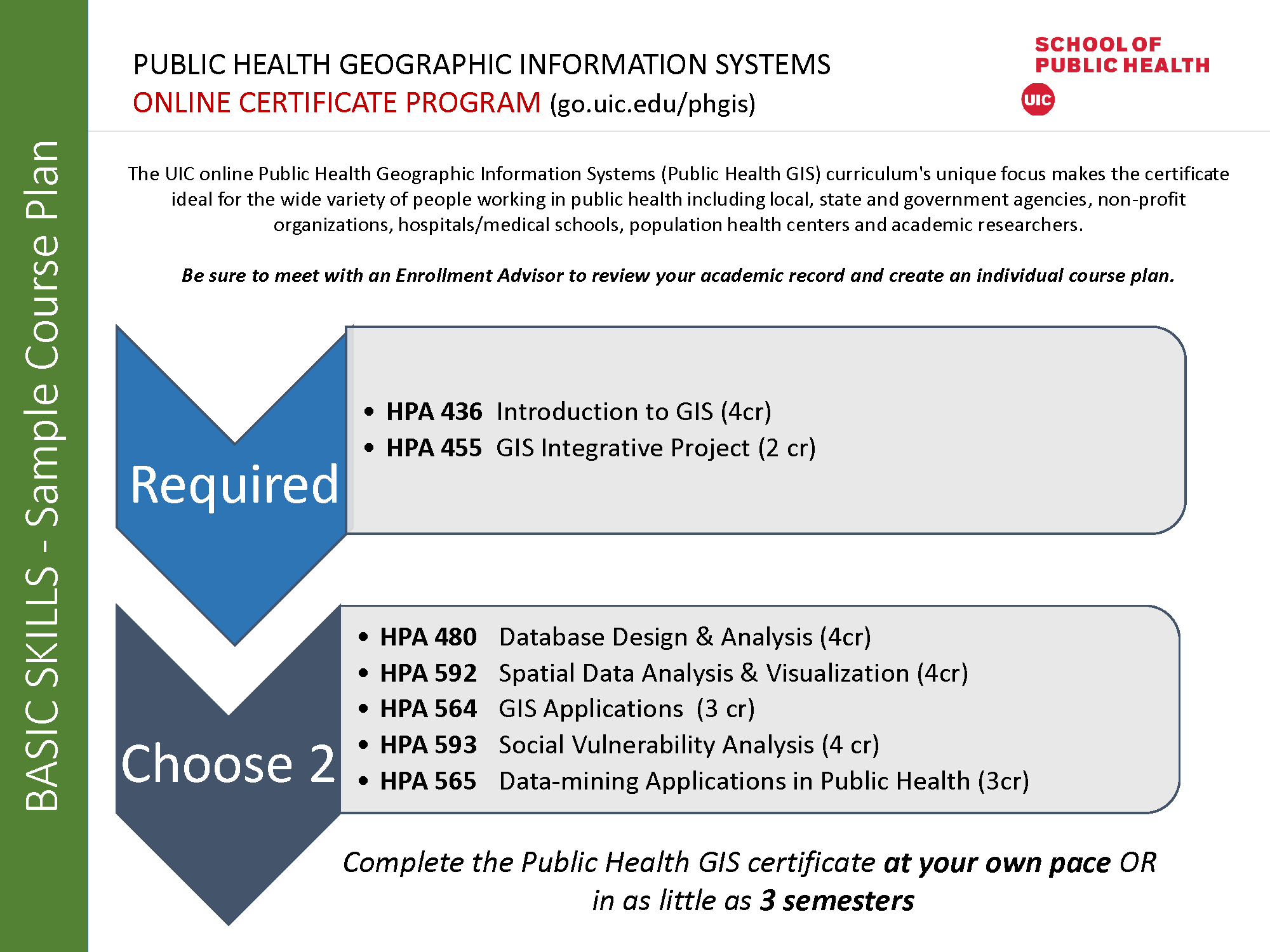
The UIC online Public Health Geographic Information Systems (Public Health GIS) certificate program curriculum's unique focus makes the certificate ideal for the wide variety of people working in public health including local, state, and government agencies, non-profit organizations, hospitals/medical schools, population health centers, and academic researchers. The certificate requires only a minimum of 13 credit hours. So, students can complete it at their own pace or in as little as three semesters (one year).
For course requirements and learning objectives, see page 13-14 of UIC’s School of Public Health Student Handbook of Academic Certificate Programs
PH-GIS curriculum offers the following courses:
UIC’s online Public Health GIS certificate program teaches you to use GIS data to help protect the economy, natural resources, and the health of people.
| Assoc. Professor & Public Health GIS Director
Program Structure
The Public Health GIS certificate program is offered completely online. The innovative curriculum design allows students to develop the required GIS skills in order to promote their individual career interests in public and environmental health.
GIS applies to all public health disciplines including geographic epidemiology (mapping and analyzing disease rates), biostatistics (geostatistics to determine relationships between space and public health indicators), community health education (identifying and evaluating programs), and health policy (identifying public health issues by location to allocate funding sources).
Whether you are new to GIS or have advanced GIS skills, you can design the program that best meets your goals. The program was developed to serve the needs of students seeking basic and/or advanced level GIS skills. Students will be able to apply those skills for analyzing social vulnerability issues or focus on a specific public health problem related to their career goals in their integrative project class.
The certificate requires only a minimum of 13 credit hours. So, students can complete it at their own pace or in as little as three semesters (one year).
Public Health GIS curriculum offers the following 16-week courses:
| Course Number | Course Title | Credit Hours | Course Offerings* *subject to change |
|---|---|---|---|
| HPA 436 | GIS for Environmental and Public Health Professionals (required for students with little or no GIS experience) | 4 | Fall, Spring & Summer Semesters |
| HPA 455 | Geographic Information Systems Integrative PROJECT | 2 | Fall, Spring & Summer Semesters |
| HPA 480 | Health Related Database Design and Analysis | 4 | Fall, Spring & Summer Semesters |
| HPA 592 | Spatial Data analysis and Visualization | 4 | Spring Semester |
| HPA 564 | Geographic Information System Application in Public Health | 3 | Fall, Spring & Summer Semesters |
| HPA 565 | Data-mining Applications in Public Health | 3 | Fall & Spring Semesters |
| HPA 593 | Social Vulnerability Analysis | 4 | Spring Semester |
Who Should Apply?
Complete the Public Health GIS certificate at your own pace OR in as little as 3 semesters
Download the Course Map

Apply the Courses Toward an UIC SPH Degree
Students in the Public Health GIS certificate program receive academic credit which may be applied toward a degree if the student later chooses to pursue one in the UIC School of Public Health (SPH). Successful completion of a certificate program does not guarantee admission to any of the degree-granting programs in the school. Students planning to later use credit from a certificate toward a degree program should consult with an advisor to ensure the coursework will count toward the degree they plan to pursue.
Click in this link for the course descriptions.